|
|
|
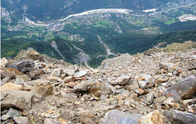
Excursions > Local excursion DerochoirThe Dérochoir rock glacier and torrential risk of the Griaz-Arrandélys catchment 27 June + 29 June Overlooking Les Houches city from about 1500m, the Dérochoir active rock glacier evacuates its material directly in the Arandellys ravines, tributary of the Griaz torrent (left bank of the Arve). The torrential activity of the watershed causes serious threat for the population downslope, and the national service de Restauration des Terrains en Montagne (RTM, ONF) is actively managing this risk since more than 120 years. Indeed, the Dérochoir area was subjected to a strong geomorphological crisis at the end of the 19th century, that led to build several civil engineering infrastructures. Since 2009, the rock glacier is monitored by PACTE and EDYTEM (ground temperature, surface displacement) and its internal structure and geomorphological settings have been investigated in details, using geophysics, UAV. The upslope-downslope interactions and the particuliar at-risk context make this site of great interest for leading research on the responses of socio-evosystems to global change. Easily hiking along the ancient Mont Blanc route, you will benefit, through this excursion, from an original panorama of natural risks in the Chamonix valley, including emerging hazards related to the destabilization of one of the rarest active rock glacier of the Mont Blanc massif. For more information, please have a look at the detailled program, and/or contact the responsible of the excursion (Philippe Schoeneich, philippe.schoeneich@univ-grenoble-alpes.fr).
Maps of the Dérochoir area. Source: IGN Géoportail |
| Online user: 1 | RSS Feed |

|
 View from the front of the Dérochoir rock glacier toward the Arandéllys torrential system (connecting to the Griaz torrent) and Les Houches.